Places & Landmarks
The parish of Castlelyons includes many places of local interest. Some are well-known landmarks, while others are remembered through placenames, roads, rivers, wells, woods and older community records.
Castlelyons, Coolagown and Britway contain a rich collection of historic buildings, ruins, burial places, religious sites and local landmarks. Some are prominent in the village; others survive quietly in fields, graveyards, lanes and working landscapes.
On this page
- Castlelyons Village
- Barrymore Castle / Castlelyons Castle
- Abbeylands and Abbey Lane
- Bridebridge and the River Bride
- Coolagown and Coole
- Corrin Hill
- Kilbarry Wood
- Mohera Standing Stone
- Pellick and the River Douglas
- Spurree Cross
- Forges and rural craft
- Creamery and co-operative life
- Schools and community buildings
- Roads, bridges and lanes
- Lime kilns
- St Nicholas’ Church and parish heritage
- Cemeteries and burial heritage
- Holy wells, Mass Rock and the religious landscape
- Thomas Kent and places of local memory
- Battle sites, folklore and oral history
- Heritage map: explore the sites
- Visiting responsibly
Visiting heritage places: use public routes only, respect private property and farm access, do not enter unstable ruins, and treat graves, monuments and places of worship with care.
Castlelyons Village
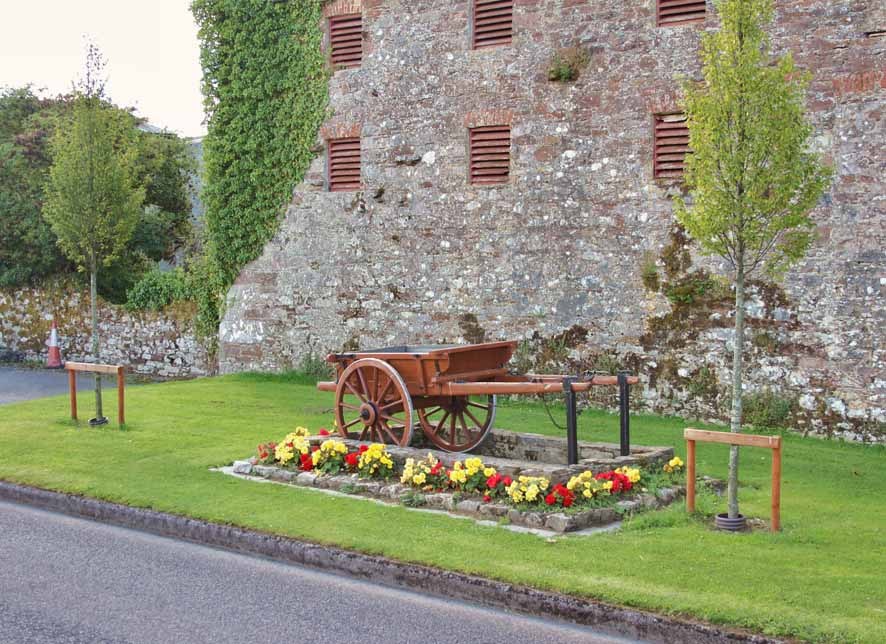
Castlelyons village is closely linked with the castle of the O’Lehanes, one of the most recognisable landmarks in North Cork.
The local archive describes the castle in its heyday with the Grand Avenue entrance, today’s Main Street, leading towards the castle. It also describes terraced gardens, an artificial lake fed by the Sean Abhainn stream, and parkland that once included a deerpark extending across the River Bride towards Killawillin Hill.
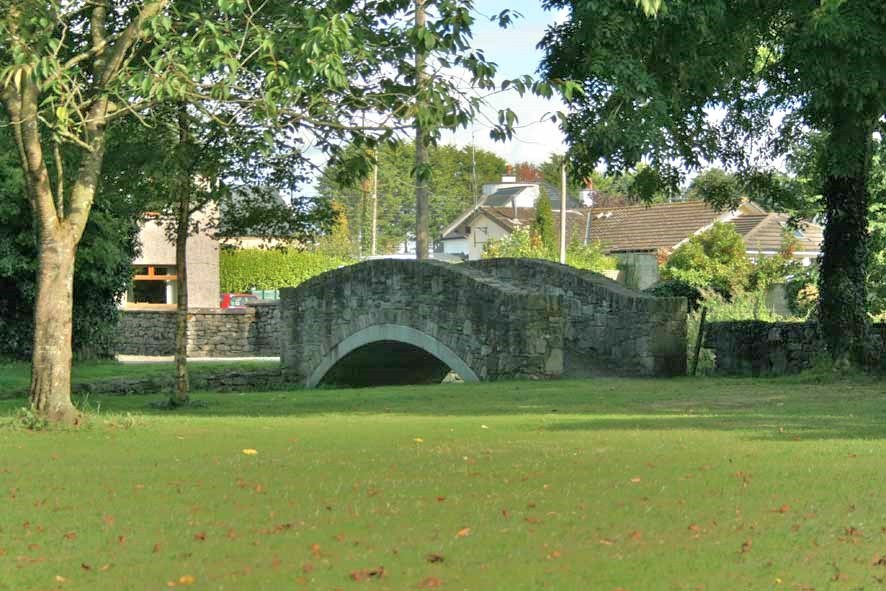
The village was more than a place of residence. The archive points to stables, mills and the activity needed to maintain a major castle estate, giving a sense of Castlelyons as an important market town in earlier times.
Today, the castle and surrounding village remain central to the identity of Castlelyons. They connect the modern community with a much older landscape of roads, rivers, stone buildings, farms and local memory.
Barrymore Castle / Castlelyons Castle


Castle, residence and village identity
The former parish archive uses both Barrymore Castle and Castlelyons Castle for the ruins associated with the Barry family and the Earls of Barrymore. It describes a substantial seventeenth-century residence developed on the site of an older castle.
Surviving masonry and prominent chimney stacks still give an impression of the scale of the later house. Archive accounts also connect the wider demesne with gardens, a deer park and routes that influenced the form of the village.
The castle remains central to the name and visual identity of Castlelyons. The ruins should be viewed only from lawful and safe positions; the map link identifies the place but does not imply public access.
Abbeylands and Abbey Lane


Abbeylands is connected with the lands of the abbey or monastery. The archive records that land for the Abbey was given by John de Barry in 1307, with the building completed in 1351 after delays. The archive also notes that the Abbey remained in use for around 200 years.
Castlelyons Abbey — A landmark at the heart of the village
Castlelyons Abbey is recorded in the Placenames Database of Ireland as Prióireacht Chaisleán Ó Liatháin, in the townland of Mohera. Its tower, church remains and enclosing walls form one of the village’s most recognisable historic groups.
The former parish archive associates the site with a medieval Carmelite foundation and describes a nave, chancel and tower among the surviving remains. Grave slabs and later local uses add further layers to the story of the place.
The abbey is important both as architecture and as a point of local identity. It connects the medieval religious landscape with the later village that grew around it.
Bridebridge and the River Bride
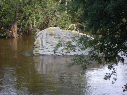
Bridebridge takes its name from Droichead na Bríde, the bridge of the Bride. The bridge replaced an older ford and became the name of the adjoining village. The River Bride continues to shape the landscape and identity of the area.
Coolagown and Coole
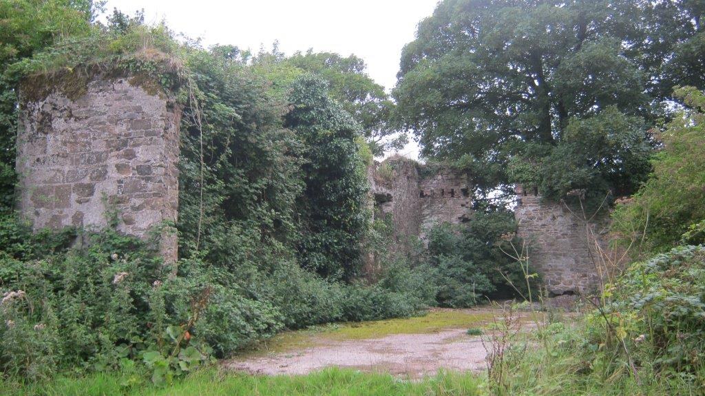

Coolagown is associated with blacksmithing and horses, while Coole is linked with the idea of a corner or nook. The archive records Coole Abbey as a twelfth- or thirteenth-century site with surviving stone features.
Coole Abbey and church — A layered religious landscape
Coole Abbey, recorded in Irish as Mainistir na Cúlach, lies in Coole Upper. The former parish archive describes a church ruin known locally as Coole Abbey and surviving features associated with early stone church building.
The wider place includes another historic church and a cemetery, making Coole an important meeting point between architectural heritage, parish history and family memory. Foundations and changes to the buildings show that the site developed over more than one phase.
The cemetery connection gives Coole particular value for local and family research. Visitors should approach only by recognised routes and avoid assuming that neighbouring land is open to the public.
Corrin Hill
Corrin Hill rises to 220 metres above sea level and takes its name from an ancient cairn. The cross on Corrin, erected in 1933, is a landmark visible from a wide area. The hill is now under Coillte ownership and public access is available from the parking area to walking routes through the hill.
Kilbarry Wood
Kilbarry, Coill an Bharraigh, is translated as Barry’s Wood. The archive records Kilbarry Wood as having two walking routes, approximately 2.5 km and 1.5 km, and notes the townland’s connection with the River Blackwater.
Mohera Standing Stone
Mohera takes its name from machaire, meaning a flat plain. The archive records a standing stone, or gallaun/menhir, in Mohera and notes that such stones may have served as burial markers, landmarks or ritual gathering places.
Pellick and the River Douglas
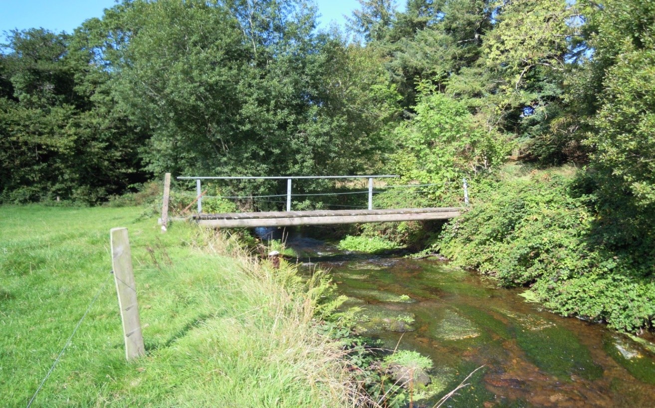
Pellick lies on the eastern side of the parish. The archive records the River Douglas as a natural boundary and describes old crossing points and a footbridge used locally for access and shortcuts across the river landscape.
Spurree Cross
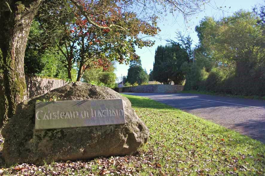
Spurree is described as the northern entrance to Castlelyons village. The archive links the name with local rock outcrops and describes Spurree Cross as the beginning of the old Grand Avenue leading towards the Castle.
Forges and rural craft
Heritage is not limited to castles and churches. The places where people worked, learned, travelled and exchanged goods explain how the community functioned from day to day.
The old archive’s reading of nineteenth-century village records notes smithies on Main Street, while later community material lists forges among local history interests. A forge was both a workplace and an essential service in a farming district.
Creamery and co-operative life
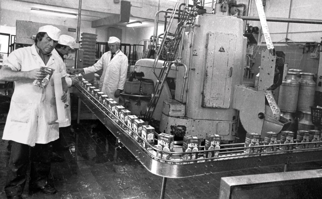
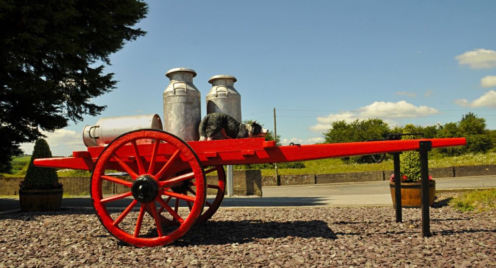
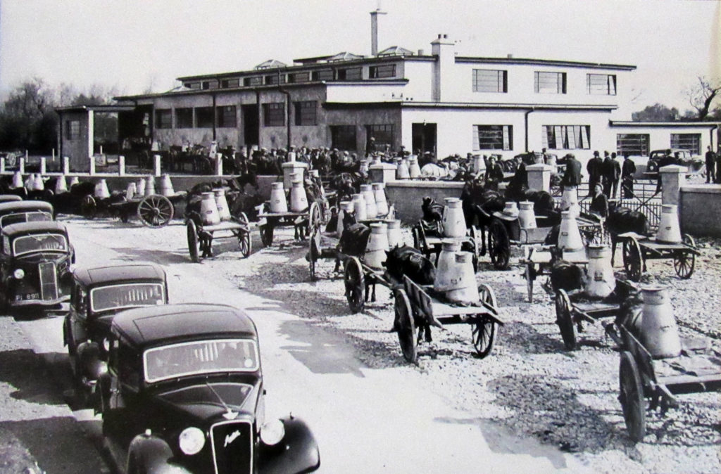
The Castlelyons creamery or co-operative formed part of the working life of the surrounding farming community, linking local agriculture with milk processing, trade and distribution. The buildings, equipment and surviving archive photographs provide a record of this important part of village life.
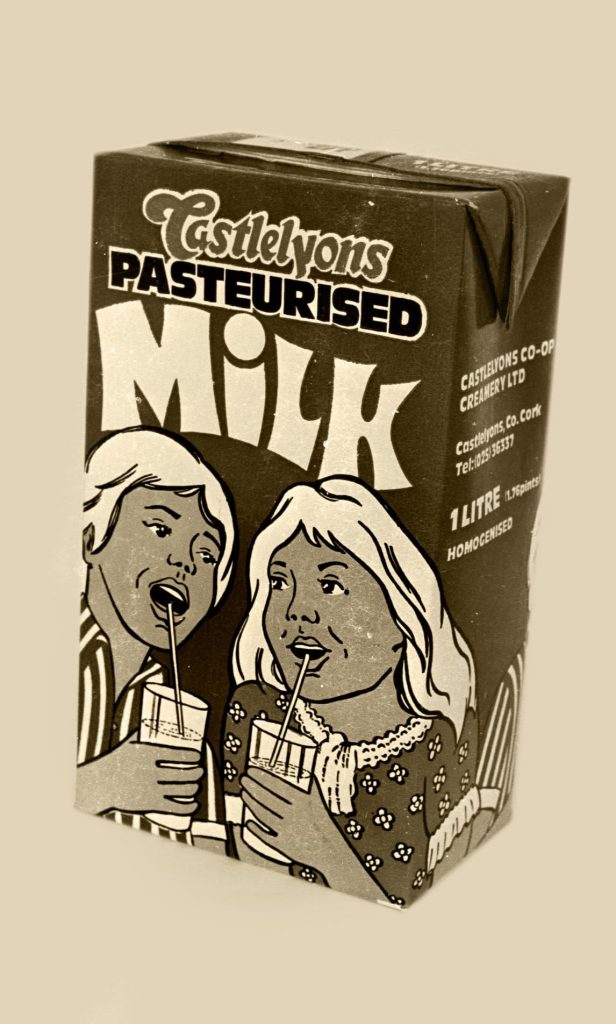
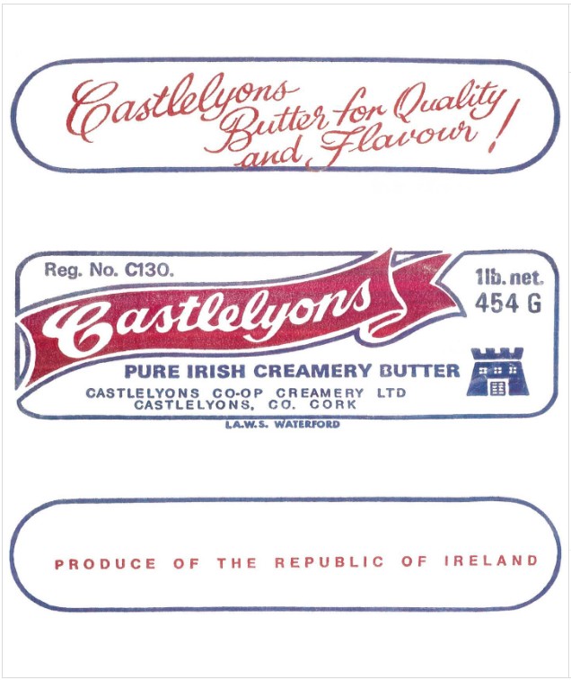
The photographic collection also preserves examples of products associated with Castlelyons, including milk and butter packaging, alongside views of the Creamery itself and the people and equipment involved in its operation. Together, these images give a glimpse of how the co-operative was represented locally and how its products changed over time.
Some of the surviving material can be dated from the photographs and packaging — including a Castlelyons pasteurised milk carton dated 1983. Further information about the history of the Creamery, its dates of operation and the people involved can be added as archive material is reviewed and verified.
Schools and community buildings
School buildings preserve the history of education as well as memories of teachers, pupils and changing settlement patterns. The archive records Castlelyons schools and former schools elsewhere in the parish; future additions can identify individual buildings once their histories and permissions are agreed.
Roads, bridges and lanes
Main Street, Church Lane, Rathcormac Lane, local bridges and older routeways connected homes, farms, churches, markets and workplaces. Their names and alignments can be valuable evidence when reading maps and family records.
Lime kilns
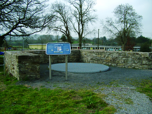
The lime kiln represents another practical rural technology: lime was important in farming and building, and surviving structures or markers help explain work that once formed part of the everyday landscape.
St Nicholas’ Church and parish heritage


A village and parish landmark
St Nicholas’ Church is a prominent part of the Castlelyons religious landscape. The former parish archive describes the present church as a nineteenth-century building that replaced an earlier place of worship and was later altered and enriched.
Features recorded in the archive include historic fonts, inscriptions, clergy burials, family tombs and memorials. Together they connect the church with worship, craftsmanship, language and generations of parish life.
The churchyard also carries national and local memory through the burial of Canon Peadar Ó Laoghaire and the Kent family association. Visitors should respect services, funerals and the privacy of people using the church and grounds.
Cemeteries and burial heritage

Burial grounds are among the most sensitive and informative heritage places in the parish. They hold family memory, inscriptions, craftsmanship and evidence of changing religious and social life. They are also active places of remembrance, not simply research sites.
Castlelyons old cemetery
The old cemetery surrounds layered medieval and later church remains. Architectural records note the Barrymore and Peard mausoleums, carved stonework and a notable collection of grave markers. The setting brings together parish, architectural and family history.
Castlelyons new cemetery
The newer cemetery continues the burial history of Castlelyons. Community Council material records local volunteer care across the old and new cemetery areas, showing conservation as a living community responsibility.
Coole Abbey cemetery
The cemetery at Coole forms part of the historic church landscape and may provide evidence for families connected with Coole and surrounding townlands.
Britway cemetery
Community Council material describes sustained local care at Britway. Its graves and inscriptions are part of the historical record of the wider parish.
Using cemetery evidence
Names, dates, family relationships and townland references on memorials may help genealogy research. Compare inscriptions with parish, civil and census records, and do not publish information about living people without consent.
Never clean, chalk, rub or move a memorial. Keep paths clear, supervise children, and give mourners and local residents priority.
Holy wells, Mass Rock and the religious landscape
The former parish archive preserves short references to holy wells at Coole Upper, Britway, Ballyroberts and Glenarousk. It records local dedications associated with St Brigid, the Virgin Mary and ‘Lady Well’. These names belong to local religious tradition and may preserve memories of former devotional practice.
A Mass Rock is also included among the historic places remembered in community material. Such sites are often understood through a combination of physical evidence, parish memory and oral tradition. No map pin is provided here because exact identification and access should be agreed locally.
Visiting small religious sites
Holy wells and Mass Rocks may stand on farmland or private ground and may be fragile, overgrown or difficult to reach. Do not cross fields, open gates or follow informal tracks without permission. Leave offerings, stonework, vegetation and water undisturbed.
Thomas Kent and places of local memory
Thomas Kent’s connection with Bawnard and Castlelyons places the events of 1916 within the local landscape. Official State records confirm that he was arrested at his Castlelyons home and executed at Cork Detention Barracks on 9 May 1916.
The parish archive connects his story with Bawnard, St Nicholas’ Church and later commemoration. These are places of both family and national memory. This page keeps the place-based introduction concise; the broader historical context belongs on History & Genealogy.
Battle sites, folklore and oral history
Community Council material records local interest in battle sites, folklore, forges, murder and mystery stories. These subjects show the range of memories attached to the landscape, but oral tradition and documentary history are not the same thing.
Local tradition
A story attached to a road, field, ruin or house may preserve an old place name or communal memory even when its details cannot be proved. It should be recorded with the name of the tradition and its source, not silently converted into fact.
Future community research
Battle-site traditions and stories of unusual events are good subjects for maps, recorded interviews and comparison with newspapers, archives and monument records. No specific battle site is mapped on this draft.
Heritage map: explore the sites
The existing Getting Here map includes verified selectors for Castlelyons Abbey, Barrymore Castle and St Nicholas’ Church. Use it to understand their relationship to the village and to open the same destinations in Google Maps.
Castlelyons Abbey
Historic abbey ruins near the village centre.
Barrymore Castle
Castle ruins at The Paddocks, south of the village centre.
St Nicholas’ Church
Parish church and churchyard south of the village centre.
Visiting responsibly
Access and safety
- Use public roads, paths and entrances only.
- Do not enter fenced, unstable or roofless ruins.
- Seek permission before crossing farmland or private ground.
- Wear suitable footwear and allow for mud, uneven ground and changing weather.
Respecting places and people
- Treat graves, memorials and places of worship respectfully.
- Do not climb, move, clean or mark stonework.
- Avoid photographing mourners, services, homes or identifiable children without consent.
- Keep noise low, supervise children and leave gates as you find them.
A map marker identifies a place; it is not confirmation of public access, opening hours or a safe route into the site.
Explore more
History & Genealogy
Read the wider story of Castlelyons and find practical guidance for family-history research.
Photo Archive
Browse curated photographs of historic places, buildings, work and community life.
Getting Here
Plan a journey and use the interactive local-place map.
This guide brings together information preserved by the former Castlelyons parish website, community publications, architectural records and local memory. It complements History & Genealogy, which tells the wider story, and the Photo Archive, which gathers the photographic collection.
This page draws on material preserved from the former Castlelyons parish website, local community publications and historical records. It will continue to be refined as further information and local knowledge are confirmed.
This page is based on selected local community archive material. If you recognise a place, have better information, or would like to suggest a correction, please contact the Castlelyons Community website team.
This page is part of a developing local history and heritage section for Castlelyons, Coolagown, Britway and surrounding townlands. The material is being reviewed gradually from local community archive records. Please contact the website team if you can help correct, improve or add to this information.
This page is based on selected local community archive material. If you can help improve or correct this page, please contact the Castlelyons Community website team.